Saturday, June 17, 2006

Roman Road Project - Geophysics

Having borrowed a RM15 resistance meter from the Sussex Archaeological Society (many thanks to them) I undertook a geophysical survey of a field on Street End Lane at Sidlesham with the assiatance of my nephew Jack.

With the weather clearly in our favour, being glouriously sunny with not a cloud in the sky.

We started by setting out a set of 10m x 10m grids on the ground and measured in the the position of the corners of the grid onto a 1:1250 scale map (to ensure that any features can be located).

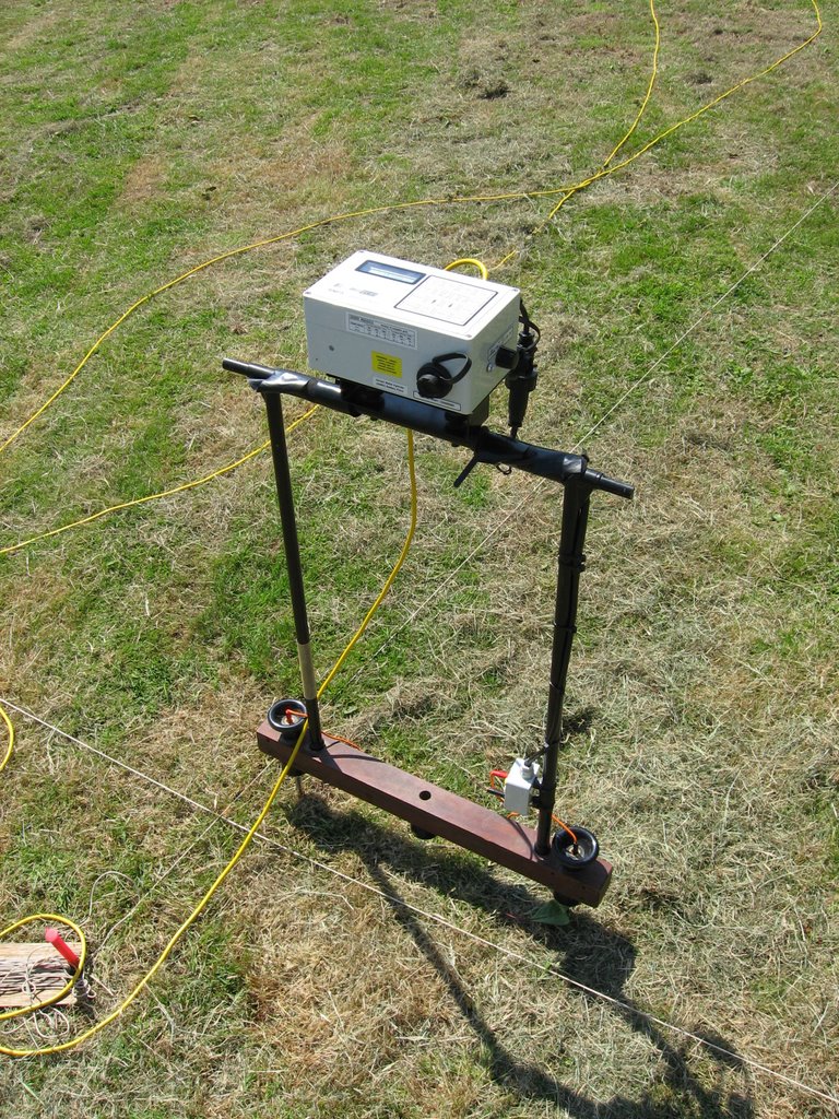
We then set up the RM15 machine (as seen on Time Team!) and set about taking recordings at 1m intervals and recording these on a sheet of paper (no high tech computer interface for us).

As the temperature hotted up, we retreated to the Anchor pub for an excellent lunch and to replenish the liquid levels. We then returned from the pub to finish off the survey.


When finished, the figures recorded were then plotted on a spreadsheet which replaced the numbers with colours to make the results easier to visualise.

The resistance survey works by measuring the flow of electricity between the probes. A low resistance reading means that the electicity is flowing easily, and may mean that there is a buried ditch or pit (as these will reatin water, helping the electricity flow).

A high rsistance reading means that the electricity can not flow very easily, and may mean that there are walls or areas of rubble.

The lighter colours show areas of low resistance, and the darker colours show the areas of high resistance.

Although nothing is immediately obvious as a feature on the results, there are a few areas that may merit further investigation at a later date.

Thursday, June 08, 2006

Roman Road Project

On the weekend of 17/18 June 2006, I will be starting work on a project to find the Roman Road south of Chichester.

In 1991, the road was located at Hunston, and I will be undertaking a resistivity survey on two plots of land on Street End Lane in Sidlesham. A brief site visit earlier in the year turned up a rim sherd from a 1st Century pot, along with a number of pieces of Roman roof tile (kindly brought to the surface by the many moles in the field!).

If there are signs of a possible road there, then this will be the furthest south of Chichester it has been located. In addition, the amount of roof tile and pottery that has been found could indicate habitation during the roman period. If the Geophysics results provide any tempting targets, then there are plans to excavate the site in conjunction with the Chichester & District Archaeological Society (see the links).

Details of the results will be posted as soon as I have processed them.

Saturday, April 22, 2006

Binsted - West Sussex 2005

Spring is here, and the new excavation season is rapidly approaching! However, I though I would post details of one of last years excavations with the Worthing Archaeological Society (http://worthingpast.blogspot.com/).

The excavation took place at Binsted in West Sussex between 27 August 2005 and 11 September 2005. Previous work had been undertaken in the 1960's, and a test pitting exercise in 2001 had provided evidence that a tile kiln was located on the site.

The site was examined by magnetometry, and a distinct 'spike' was clearly visible. However, the large amounts of broken tile laying around the field were also a good indiciation of where the kiln would be located!

During the first two days of the dig, we located a large area of chalk blocks which were defined by linear bands of red tiles. A number of voids were evident between the chalk blocks, and these were measured to be up to 0.5 metre deep.

The whole area under excavation was rich with broken fragments of tile. The area of chalk blocks was also beginning to reveal a number of highly fired tile bars. Care had to be taken as it became obvioud that there were large areas of vpoids under the chalk layer, and the lightest member of the excavation team had the job of cleaning back the chalk!

The chalk blocks were gradually removed to reveal the tile bars that made up the floor of the firing chamber. Sondage trenches were also dug along the sides of the structure to reveal that the kiln had actually been constructed of tiles which had been stacked together to form the walls.

A sondage trench was dug along the north side of the structure as we had determined that this would be the site of the entrance to the firing chamber. Eventually, we removed the whole of the area of chalk blocks, and extended the sondage trenches aroud the whole area of the kiln structure. The preservation of the firing bars and kiln structure was extremely good, partially thanks to the careful ploughing of the farmer, who always raised the plough when approaching the structure.

On the floor at the entrance to the firing chamber, two beer flagons were found, which were dated to the 13th or 14th century. The flagons showed no sign of burning, and therefore helped to provide good dating evidence for the last firing of the kiln.


Having fully excavated the strucure over two weeks, we had found a number of sherds of medieval green glazed pottery and more than 1.3 metric tons of tile, including decorated ridge tiles. The structure was recorded, and then the chalk blocks were replaced to cover and protect the kiln, and then the excavation was back filled.

It has been decided to revisit the site in 2006 to examine the entrance to the kiln, along with a possible chalk packed road that was found to one side of the structure.

Welcome!

Welcome to my site where I will be publishing details of various excavation I have attended.


I hope you may find these interesting.